
Biotope Mapping
BIOTOPE MAPPING OF THE GIPPSLAND LAKES
The Gippsland Lakes supports a resident, maternal-based population of only 63 Burrunan dolphins (Tursiops australis), with an annual wintering influx that temporarily doubles the population size (Charlton-Robb et al. 2015: Henderson, Charlton-Robb et al. submitted). The Burrunan is currently listed as Endangered under Victoria’s Flora and Fauna Guarantee Act and there is now a high priority to protect these small, geographically and genetically isolated populations.
Our previous research shows a dramatic shift in habitat use in the Gippsland Lakes across seasons, with the resident dolphins almost exclusively using Lake Victoria during summer, whilst winter saw a shift to the almost exclusive use of Lake King and Reeves Channel (Henderson, Charlton-Robb et al. submitted). Potential drivers for a shift in habitat use of dolphins have been documented elsewhere, including fluctuations in ocean currents and fronts, predator pressure, prey availability and the effects of anthropogenic (human-induced) sources, such as boat traffic.
Is the shift we have observed based on anthropogenic or environmental factors?
Whilst we have collected data on the sightings and distribution of the Burrunan dolphin and can classify seasonal high usage areas, we have limited knowledge on the environmental variables that could be the drivers of this distribution. Is it that the dolphin’s distribution reflect seasonal fish distribution, are areas with fish nursery grounds, are seagrass habitat or sandy substrate?
Fathom Pacific Pty Ltd and Australian Marine Ecology Pty Ltd jointly developed a standardised biotope classification system for use on projects in Australia and internationally. The classification scheme, coined CBiCS (Combined Biotope Classification Scheme), is based on an adaptation of two international habitat mapping systems, both with documentation and provenance: the US-based CMECS and the European-based JNCC-EUNIS schema. Biotope Mapping methodologies involve identifying key exiting infrastructure already in place; segmentation, ground-truthing and clustering of abiotic/biotic data; and biotope mapping and reporting. This project directly aligns with DELWP’s “Victorian Biotope Mapping Project”.
By classifying the habitat we can then correlate environmental/habitat characteristics and high dolphin usage areas to explore possible environmental drivers in much greater detail.
Habitat Mapping & Classification
Combined Biotope Classification Scheme (CBiCS) currently used by DELWP in the wider “Victorian Biotope Mapping Project”.
~10km2 of mapping across five key locations in the Gippsland Lakes (correlated with high dolphin sighting location indicative of key habitats of significance).
Three core elements of biotope mapping:
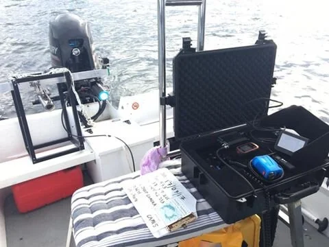
Developing systems that make use of new high-resolution data products, namely multispectral aerial imagery, multibeam echo-sounding and LiDAR, and machine-learning techniques to inform interpretations of abiotic habitats
Developing systems that facilitate the use of new techniques, namely optical-acoustic data from robotic instrumentation, to facilitate interpretations of biotic components
Developing a hierarchical classification system that standardises new mapping while maintaining flexibility for inclusion of historical mapping
This project is funded by the Victorian State Government for the Gippsland Lakes.
If you would like to help us get on the water and continue to conduct our research, consider a donation! As a small not-for-profit organisation, every little bit goes a long way.